


Revolutionizing the Field: How Drones are Transforming Precision Agriculture
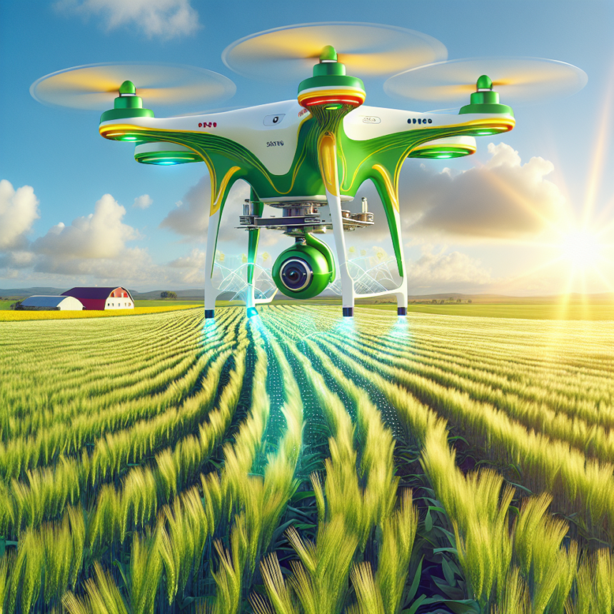
In recent years, the agricultural landscape has witnessed a technological revolution, with drones emerging as vital tools that are reshaping the practices of modern farming. The use of drones in precision agriculture marks a significant turning point in how farmers monitor crop health, manage resources, and optimize yields. By leveraging aerial data, farmers can make informed decisions that lead to enhanced productivity and sustainability.
The Rise of Precision Agriculture
Precision agriculture is an innovative farming practice that utilizes technology to monitor and manage field variability in crops. This methodology aims to ensure that crops receive the right amount of resources—including water, fertilizers, and pesticides—at the precise time they need them. The result is a more efficient farming process that maximizes output while minimizing waste and environmental impact.
The Role of Drones in Agriculture
Drones, or unmanned aerial vehicles (UAVs), have become an integral part of precision agriculture for several reasons:
-
Real-Time Data Collection: Drones are equipped with advanced imaging technology, including multispectral and hyperspectral cameras that capture high-resolution images of crops. This allows farmers to analyze their fields’ health and spot issues such as pest infestations, disease spread, or nutrient deficiencies almost in real-time.
-
Efficient Crop Monitoring: Traditionally, crop monitoring required labor-intensive methods such as walking through fields or using large machinery. Drones allow for rapid assessment over large areas, drastically reducing the time and costs associated with manual inspections.
-
Customizable Flight Paths: Farmers can program drones to fly specific routes over their fields, ensuring consistent coverage and the ability to revisit areas of concern. This precision allows for better monitoring and management of crop conditions.
-
Variable Rate Application: Drones can also be used for precision pesticide and fertilizer application. By analyzing data collected during their flights, farmers can apply resources only where and when they are needed, leading to decreased costs and minimized environmental impact.
- Enhanced Mapping and Planning: Drones offer capabilities in creating detailed topographical maps of farmland. This information helps in planning irrigation systems, identifying drainage issues, and optimizing land use.
Case Studies of Drone Implementation
The integration of drones in farming is already making waves across the globe. For instance, farmers in California’s wine country utilize drone technology to monitor vineyard health. The data collected enables them to assess grape maturity levels and determine the perfect time for harvest, thus improving wine quality.
Similarly, in Australia, farmers are employing drones to track soil moisture levels, allowing them to optimize irrigation practices in arid regions. This not only conserves water but also promotes healthier crop growth, showcasing the efficiency of drones in resource management.
Challenges and Considerations
Despite the numerous benefits, challenges remain in drone implementation for precision agriculture. Regulatory hurdles, such as airspace restrictions and licensing requirements, can complicate usage. Additionally, there may be a learning curve for farmers unfamiliar with drone technology.
Moreover, ensuring data security and privacy must also be considered, as aerial imagery can expose sensitive information related to crop production. Nevertheless, with proper training and support, these challenges can be surmounted, paving the way for widespread drone adoption in agriculture.
The Future of Agriculture with Drones
Looking ahead, the future of agriculture is increasingly intertwined with drone technology. As drones continue to evolve, we can expect advancements in artificial intelligence and machine learning that will allow for even more precise data analysis and decision-making. The integration of drones with other precision agriculture technologies, such as IoT sensors and data analytics platforms, will further enhance farming efficiency and sustainability.
Conclusion
Drones are not just a futuristic concept; they are a practical tool that is revolutionizing precision agriculture today. By providing farmers with unprecedented insights into crop health and resource management, drones are setting the stage for a more productive and sustainable agricultural sector. Embracing this technology will enable farmers to adapt to changing environmental conditions and market demands, ultimately ensuring food security for future generations.
FAQs
1. How much do agricultural drones typically cost?
The cost of agricultural drones can range from a few hundred dollars to several thousand, depending on the features and technology. Entry-level drones start around $500, while those equipped with advanced imaging capabilities can go up to $10,000 or more.
2. Do I need a license to operate a drone for farming?
Yes, in many countries, you need to follow specific regulations, which often include obtaining a Remote Pilot Certificate or similar licensing. It’s crucial to check local regulations before operating a drone.
3. What kinds of data can drones provide for farmers?
Drones can provide a variety of data, including NDVI (Normalized Difference Vegetation Index) maps, crop health assessments, moisture levels, and high-resolution imagery for mapping and planning purposes.
4. Can drones help with pest control?
Yes, drones can be equipped to apply pesticides and herbicides more accurately, targeting specific areas that need treatment and reducing the overall quantity of chemicals used.
5. Are drones effective for all types of crops?
Yes, drones can be beneficial for a variety of crops, including grains, fruits, vegetables, and even ornamental plants. Their effectiveness varies based on the type of monitoring and data collection needed for specific crops.